Abstract from upcoming paper: “An inverse planned oil release validation method for estimating oil slick thickness from thermal contrast remote sensing by in-scene calibration”
*news item will be updated with more details in the SeaSpires package soon
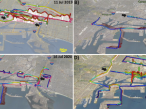
The approach describes a method to estimate floating oil slick thickness based on thermal infrared contrast remote sensing using data collected by the SeaSpiresTM science package using an in-scene calibration. SeaSpires combines thermal infrared and visible video remote sensing imagery with position and orientation data for airborne deployments. For boat deployments, SeaSpires includes meteorology data. The approach was demonstrated for airborne data collected from natural seeps in the Coal Oil Point seep field, offshore southern California. Remote sensing data were acquired in the cross-slick direction of oil slick segments that were targeted for collection, termed “Collects.” Collects consisted of booming, skimming, and off-loading the oil slick segment into buckets for analysis at the laboratory. Each collect provided an in-scene calibration of oil thickness with respect to brightness temperature contrast and is a planned oil-release experiment run in reverse. Brightness temperature contrast was the brightness temperature difference between the oil and oil-free sea surface.