
Mobile measurement platform
Emissions and Source Characterization in Real-World Conditions.
Adaptive mobile surveys combine trace-gas, aerosol, wind, and contextual measurements for plume mapping, source fingerprinting, and emissions estimation across industrial, agricultural, and natural settings.
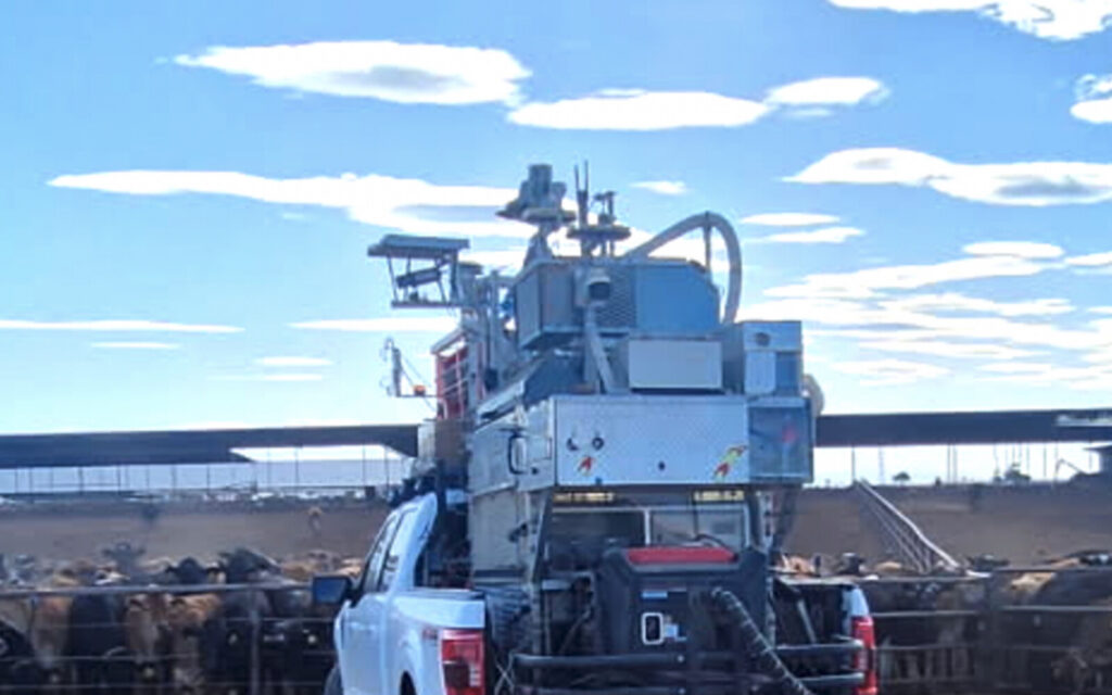
Platform applied
Adaptive Mobile Measurement from Plume Mapping to Targeted Sampling.
SISTER2 connects synchronized field context, real-time visualization, trace-gas and aerosol measurements, and laboratory analysis.
Mobile measurement
Emissions & Source Characterization
Adaptive mobile surveys combine trace-gas, aerosol, wind, and contextual measurements for plume mapping, source fingerprinting, and emissions estimation across industrial, agricultural, and natural settings.
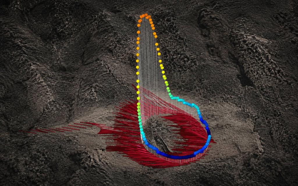
Adaptive emissions surveys
Active, Idle & Abandoned Wells
Mobile downwind transects, real-time trace-gas visualization, wind-informed plume interpretation, and targeted sampling for difficult-to-locate hydrocarbon emissions.
Adaptive field methods
Measurements That Guide the Survey While It Is Underway.
Live observations support route refinement, repeated transects, source discrimination, targeted sampling, and integration across spatial scales.
Improve science outcomes
Respond to Conditions in Real Time
Live measurement displays support route refinement, repeated transects, slower investigation of areas of interest, and targeted sample collection while the survey is underway. I.e. shifting winds.
Source discrimination
Separate Background from Source Signals
Multiple trace-gas, aerosol, wind, and contextual measurements are evaluated together to identify patterns, distinguish competing sources, and improve interpretation. I.e. a pipeline leak on a dairy where cows also emit methane.
Targeted sampling
Connect Field Observations with Laboratory Analysis
Data fusion combines SISTER2’s unprecedented 18 trace-gas temporal data with 60+ species, high-compositional-resolution laboratory sampling. I.e. refinery plume sampling for BTEX exposure assessment.
Nested grid data
Integrate Measurements Across Scales
Nested grid data is integrated across spatial scales to compare and validate independently derived results. I.e. satellite-derived refinery emissions validated against surface in-situ measurements.
Technical record
Measurement Profile and Mobile Plume Analysis.
The homepage technical record summarizes the platform and field methods available for program evaluation.
Mobile measurement platform
SISTER2 Measurement Profile
Trace-gas measurements, aerosol size distributions, isotopic analysis, targeted air sampling, real-time visualization, and synchronized field context for adaptive mobile surveys.
Emissions & source analysis
Mobile Plume Mapping & Quantification
Adaptive transects, multi-gas source fingerprinting, wind-informed plume interpretation, anomaly mapping, targeted sampling, and emissions estimation.